
In the depths of the Indonesian rainforest, a cell phone nestles against a tree trunk—listening. The phone is not lost, quite the opposite. Incongruous but invaluable, the phone is part of a network of devices placed throughout the forest to listen for the telltale sounds of illegal logging. Amidst the rustle of leaves, the scampering of critters, and the steady drip of moisture, the sound of a lorry or chainsaw is an alarm bell that can bring forest rangers hurrying to the scene. It’s just one of the ways that technology is helping conservationists in the fight to protect wildlife and the planet.
The advance of technology is often seen as a risk for the environment: From the invention of the plough to carve the landscape, through the industrial revolution, to the electronic age’s thirst for Earth’s limited resources. But amidst the growing concern for the plight of animals and the environment, technology is coming to the rescue. A recent survey of conservationists highlighted how much they valued technological tools to help monitor, protect, and alleviate the damage being done—and how optimistic they were that advances in technology could play an even greater role in conservation.
In the savannah, a rare black rhino stirs up the dust as it strides through the bush towards a watering hole. It follows a well-beaten path and is oblivious to the hidden camera capturing its image. Camera traps are among conservation’s most widely deployed technologies, using infrared sensors to detect a “warm” animal crossing their path and trigger the digital photograph or video. The striking images they capture are often used to promote conservation, but they also deliver candid insights into the lives of animals. The data collected from camera traps, often operating remotely for months, provides crucial details on the location, population, and behavior of a species, helping conservationists understand when, where, and how to help them.
Orbiting in the silence of space, an Earth observation satellite shows the world from a different angle with a single shot capturing 1,930 square miles (5,000 sq km) in astonishing detail. Powerful computers analyze these epic images to count individual species and track their movement across vast areas. Satellite images also help monitor the health of ecosystems, detecting droughts, floods, and changes to the landscape, while spotting wildfires and deforestation in time to minimize the damage. Flying closer to the ground, drones carrying Lidar use light pulses from lasers to build a 3D picture of an area. Able to spot erosion, assess flood risk, estimate carbon stocks, and even establish a habitat’s suitability to support wildlife, Lidar is proving an invaluable tool for monitoring environmental change at scale.
From the carving of an ice shelf to the buzz of a forest floor, nature is noisy. These sounds can be recorded and analyzed to help tell the story of an ecosystem. Discrete and relatively inexpensive, acoustic sensors can identify species, their numbers, composition, and behaviors, and are increasingly used to study endangered species and to understand how animals use a habitat. Along with tagging and tracking, especially of marine mammals like whales, these conservation technologies are making a real difference. But technology never stands still and with innovation comes the prospect of even more powerful tools. Two of the most promising are networked sensors and AI.
From a photographic plate, to a roll of film, to a digital SD card, camera traps have long relied on their data being physically retrieved. Networked sensors change that. They connect camera traps, acoustic sensors, tracking devices, and more to the internet—making their data immediately accessible from anywhere. This isn’t easy as most devices operate far from standard cellular or internet coverage, but it’s worth the effort. Real-time data not only helps counter imminent threats—the crack of a poacher’s gun or the revving of a logger’s chainsaw—but also gives conservationists eyes and ears on the ground eyes in a way that lets them build a more comprehensive picture of animal behavior.
To extract useful information from this ever increasing volume of data, conservationists are turning to AI. This can quickly and accurately analyze conservation data, identifying a rare species from among thousands of images, or picking out a particular animal sound from the hubbub of a forest recording—making the process more efficient and the data more useful. AI can also be taught to look for specific individuals, identifying a particular bear through facial recognition or a particular whale by comparing the shape of its fluke to a global database. AI can even use algorithms to help predict the movement of animals and the behavior of poachers. In fact, AI can be taught to detect almost anything—that’s something technology services company Capgemini is using to great effect.
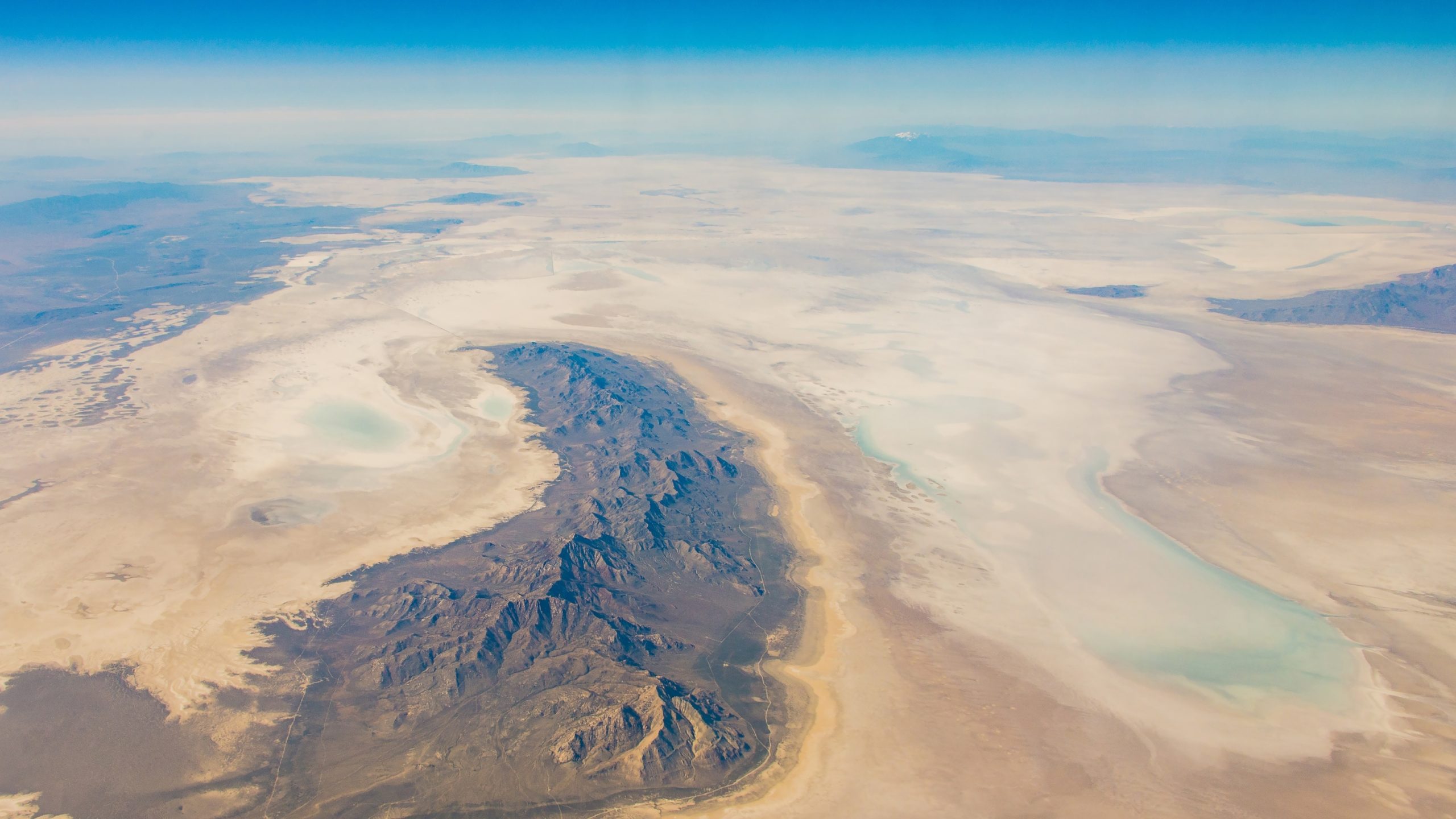
In the heat of the Mojave Desert, the roar of a petrol engine shatters the stillness and sends creatures scurrying for cover. Recreational use of this vast landscape is encouraged—special trails have been created for off-roaders to enjoy—but human activity needs to be carefully monitored to preserve the environment. The few who break the rules, deliberately carving out their own off-road tracks, are upsetting the delicate balance of the ecosystem: It’s important to quickly find them and stop them. However, the desert’s size and dry conditions make the illegal tracks challenging to spot with the naked eye, even when using satellite imagery. Capgemini is bringing the power of AI to the rescue.
Capgemini partners with companies and organizations to transform their activities by harnessing the power of technology. Working with the Nevada chapter of The Nature Conservancy, Capgemini is working on a solution to enable teams on the ground to determine which areas of the desert are in most urgent need of intervention. They started by identifying indicators of landscape and ecosystem degradation in a key region of the Mojave, looking for patterns in pixels of the aerial imagery. They then developed AI algorithms to remotely detect and highlight these indicators. The Capgemini-developed solution uses geospatial AI, computer vision, and advanced deep learning to study aerial imagery and identify new off-road trails, making it possible to cross-reference these with environmental data, such as the nesting sites of protected species, to identify the areas where intervention should be prioritized. Armed with this information, the Nature Conservancy will be better equipped to support its partners in protecting priority areas—using technology to maximize their conservation efforts.
From AI in the Mojave Desert to camera traps in the savannah, satellites in space, and cell phones strapped to trees, conservationists have an ever-growing range of technologies at their disposal. Deploying them could be crucial. Late last year, a supercomputer using new scientific modelling predicted that around a quarter of all animal and plant species could be extinct by the end of this century. Action has never been more urgent, and technology could well be the decisive tool that helps preserve life on Earth.
This content was originally published here.